Geolocate

Narail topographic map

Click on the map to display elevation.

About this map

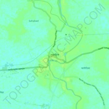
Name: Narail topographic map, elevation, terrain.

Location: Narail, Narail District, Khulna Division, Bangladesh (23.13500 89.46500 23.21500 89.54500)

Average elevation: 16 ft

Minimum elevation: 3 ft

Maximum elevation: 33 ft

Gear up for your next adventure:

🧯Portable Fire Pit - Compact fire pit for camping spots
📶Vehicle Signal Boosters - Improve reception in rural areas while driving to trailheads
🥾Women's Hiking Boots - Top-rated trail boots with ankle support and superior grip
🪶Wildlife Field Guides - Learn animal tracking and species ID
Backpacking Tents - Weight-optimized shelters for multi-day topographic surveys

As an Amazon Associate, this site earns from qualifying purchases at no extra cost to you.