
Thank you for supporting this site ❤️
Make a donation
Make a donation
Gear up for your next adventure:
As an Amazon Associate, this site earns from qualifying purchases at no extra cost to you.
Prati topographic map
Click on the map to display elevation.
Thank you for supporting this site ❤️
Make a donation
Make a donation
Gear up for your next adventure:
As an Amazon Associate, this site earns from qualifying purchases at no extra cost to you.
About this map
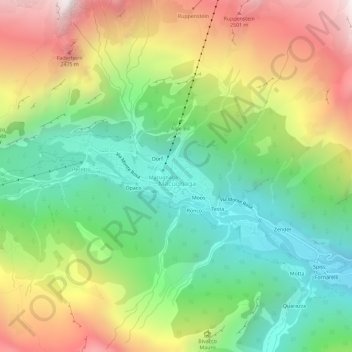
Name: Prati topographic map, elevation, terrain.
Location: Prati, Macugnaga, Verbano-Cusio-Ossola, Piedmont, 28876, Italy (45.94919 7.94711 45.98919 7.98711)
Average elevation: 5,935 ft
Minimum elevation: 3,783 ft
Maximum elevation: 9,094 ft
Thank you for supporting this site ❤️
Make a donation
Make a donation
Gear up for your next adventure:
As an Amazon Associate, this site earns from qualifying purchases at no extra cost to you.