
Thank you for supporting this site ❤️
Make a donation
Make a donation
Gear up for your next adventure:
As an Amazon Associate, this site earns from qualifying purchases at no extra cost to you.
Makalu topographic map
Click on the map to display elevation.
Thank you for supporting this site ❤️
Make a donation
Make a donation
Gear up for your next adventure:
As an Amazon Associate, this site earns from qualifying purchases at no extra cost to you.
About this map
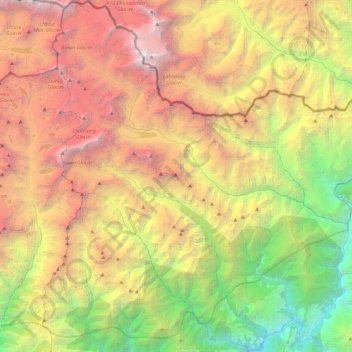
Name: Makalu topographic map, elevation, terrain.
Location: Makalu, Sankhuwasabha, Province #1, Nepal (27.54003 86.96712 27.95792 87.30621)
Average elevation: 13,333 ft
Minimum elevation: 2,411 ft
Maximum elevation: 27,480 ft
Thank you for supporting this site ❤️
Make a donation
Make a donation
Gear up for your next adventure:
As an Amazon Associate, this site earns from qualifying purchases at no extra cost to you.