
Thank you for supporting this site ❤️
Make a donation
Make a donation
Gear up for your next adventure:
As an Amazon Associate, this site earns from qualifying purchases at no extra cost to you.
Antisana topographic map
Click on the map to display elevation.
Thank you for supporting this site ❤️
Make a donation
Make a donation
Gear up for your next adventure:
As an Amazon Associate, this site earns from qualifying purchases at no extra cost to you.
About this map
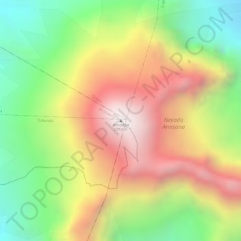
Name: Antisana topographic map, elevation, terrain.
Location: Antisana, Cotundo, Archidona, Napo, Ecuador (-0.48455 -78.14236 -0.48445 -78.14226)
Average elevation: 17,077 ft
Minimum elevation: 15,417 ft
Maximum elevation: 18,694 ft
Thank you for supporting this site ❤️
Make a donation
Make a donation
Gear up for your next adventure:
As an Amazon Associate, this site earns from qualifying purchases at no extra cost to you.