
Thank you for supporting this site ❤️
Make a donation
Make a donation
Gear up for your next adventure:
As an Amazon Associate, this site earns from qualifying purchases at no extra cost to you.
Melfort topographic map
Click on the map to display elevation.
Thank you for supporting this site ❤️
Make a donation
Make a donation
Gear up for your next adventure:
As an Amazon Associate, this site earns from qualifying purchases at no extra cost to you.
About this map
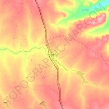
Name: Melfort topographic map, elevation, terrain.
Location: Melfort, Goromonzi, Mashonaland East, Zimbabwe (-18.04706 31.28567 -17.96706 31.36567)
Average elevation: 4,977 ft
Minimum elevation: 4,583 ft
Maximum elevation: 5,167 ft
Thank you for supporting this site ❤️
Make a donation
Make a donation
Gear up for your next adventure:
As an Amazon Associate, this site earns from qualifying purchases at no extra cost to you.