Geolocate

Wer topographic map

Click on the map to display elevation.

About this map

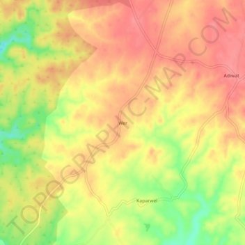
Name: Wer topographic map, elevation, terrain.

Location: Wer, Bichiwara Tehsil, Dungarpur, Rajasthan, 314801, India (23.69076 73.57563 23.73076 73.61563)

Average elevation: 1,152 ft

Minimum elevation: 988 ft

Maximum elevation: 1,240 ft

Gear up for your next adventure:

🥤Water Filter Bottle - All‑in‑one filter bottle for safe hydration
🌐World Map Poster - Decorative world maps with topographic info
🧯Emergency Survival Kit - All‑in‑one survival essentials for the backcountry
🪶Wildlife Field Guides - Learn animal tracking and species ID
🕶️Glacier Sunglasses - Side shields to protect eyes from high-altitude snow glare

As an Amazon Associate, this site earns from qualifying purchases at no extra cost to you.