
Haar topographic map
Click on the map to display elevation.
Haar
Das Haarer Trinkwasser wurde zunächst in Brunnen am Rande des Gemeindegebietes gefördert. Um die Versorgung des wachsenden Ortes auch für die Zukunft langfristig zu sichern, wurden neue Quellen erschlossen. So stammt seit 2011 das geförderte Wasser aus einem Gebiet im Höhenkirchener Forst, in dem das Wasser in größeren Mengen und besserer Qualität vorhanden ist.
About this map
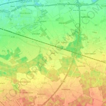
Name: Haar topographic map, elevation, terrain.
Location: Haar, Landkreis München, Bayern, 85540, Deutschland (48.06622 11.68896 48.14622 11.76896)
Average elevation: 1,781 ft
Minimum elevation: 1,690 ft
Maximum elevation: 1,867 ft