
Thank you for supporting this site ❤️
Make a donation
Make a donation
Gear up for your next adventure:
As an Amazon Associate, this site earns from qualifying purchases at no extra cost to you.
Alemeda topographic map
Click on the map to display elevation.
Thank you for supporting this site ❤️
Make a donation
Make a donation
Gear up for your next adventure:
As an Amazon Associate, this site earns from qualifying purchases at no extra cost to you.
About this map
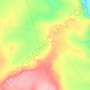
Name: Alemeda topographic map, elevation, terrain.
Location: Alemeda, Sululta, North Shewa (K4), Oromia Region, Ethiopia (9.30667 38.70667 9.32667 38.72667)
Average elevation: 8,438 ft
Minimum elevation: 8,084 ft
Maximum elevation: 8,665 ft
Thank you for supporting this site ❤️
Make a donation
Make a donation
Gear up for your next adventure:
As an Amazon Associate, this site earns from qualifying purchases at no extra cost to you.