Geolocate

Pirbright topographic map

Click on the map to display elevation.

About this map

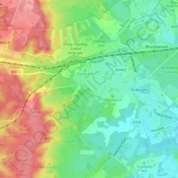
Name: Pirbright topographic map, elevation, terrain.

Location: Pirbright, Guildford, Surrey, England, United Kingdom (51.26785 -0.70048 51.31737 -0.61862)

Average elevation: 217 ft

Minimum elevation: 102 ft

Maximum elevation: 394 ft

Gear up for your next adventure:

🥤Water Filter Bottle - All‑in‑one filter bottle for safe hydration
🎒Day Hiking Backpack - Lightweight backpack perfect for day trips and outdoor adventures
🪶Camping Sleeping Pad - Comfortable sleeping pad for backpacking
🔋Rechargeable Batteries - Power up your outdoor devices
📻Weather Alert Radios - Stay informed of storm risks while off-the-grid

As an Amazon Associate, this site earns from qualifying purchases at no extra cost to you.