Geolocate

New Point topographic map

Click on the map to display elevation.

About this map

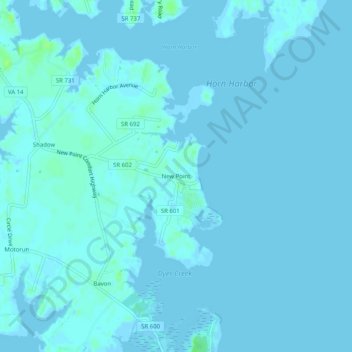
Name: New Point topographic map, elevation, terrain.

Location: New Point, Mathews County, Virginia, 23125, United States (37.32569 -76.29772 37.36569 -76.25772)

Average elevation: 3 ft

Minimum elevation: -10 ft

Maximum elevation: 33 ft

Mathews County trails, hiking, mountain biking, running and outdoor activities

Gear up for your next adventure:

💧Water Filtration Bottles - Safely drink from streams and lakes while exploring
🧭Map Reading Tools - Tools and kits for map navigation
🍳Camping Cook Set - Complete cookware for outdoor meals
📌Outdoor GPS Map App - Apps and devices for digital topographic navigation
🕶️Glacier Sunglasses - Side shields to protect eyes from high-altitude snow glare

As an Amazon Associate, this site earns from qualifying purchases at no extra cost to you.