Geolocate

Pangot topographic map

Click on the map to display elevation.

About this map

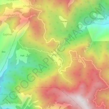
Name: Pangot topographic map, elevation, terrain.

Location: Pangot, Kosya Kutauli, Nainital, Uttarakhand, 263001, India (29.40413 79.40704 29.44413 79.44704)

Average elevation: 6,572 ft

Minimum elevation: 4,531 ft

Maximum elevation: 8,547 ft

Gear up for your next adventure:

🪑Ultralight Camp Chairs - Portable seating for resting after a long day of mapping
⛑️Personal Locator Beacon - Safety beacon for emergencies
🎒Outdoor Daypacks - Lightweight backpacks designed for carrying maps and essential gear
🧭Orienteering Set - Complete compass and map reading kit
🔥Fast-Boil Camping Stoves - Efficient cooking systems for quick trail meals

As an Amazon Associate, this site earns from qualifying purchases at no extra cost to you.