Geolocate

Bernay topographic map

Click on the map to display elevation.

About this map

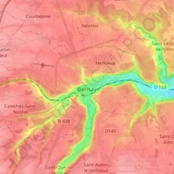
Name: Bernay topographic map, elevation, terrain.

Location: Bernay, Eure, Normandy, Metropolitan France, 27300, France (49.06080 0.53083 49.12171 0.66482)

Average elevation: 502 ft

Minimum elevation: 289 ft

Maximum elevation: 577 ft

Other topographic maps

Click on a map to view its topography, its elevation and its terrain.

Bray

France > Normandy > Eure > Bray > Bray

Average elevation: 495 ft

Gear up for your next adventure:

🪶Survival Guide Book - Expert advice for emergency preparedness
💧Water Purification System - Clean water on the trail with reliable purifiers
🪶Wildlife Field Guides - Learn animal tracking and species ID
🔥Camping Stove - Portable stove for camping and backcountry cooking
👟Men's Trail Runners - Lightweight footwear for fast-paced exploration and light hiking

As an Amazon Associate, this site earns from qualifying purchases at no extra cost to you.