
Thank you for supporting this site ❤️
Make a donation
Make a donation
Gear up for your next adventure:
As an Amazon Associate, this site earns from qualifying purchases at no extra cost to you.
Zemmouri topographic map
Click on the map to display elevation.
Thank you for supporting this site ❤️
Make a donation
Make a donation
Gear up for your next adventure:
As an Amazon Associate, this site earns from qualifying purchases at no extra cost to you.
About this map
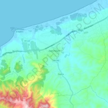
Name: Zemmouri topographic map, elevation, terrain.
Location: Zemmouri, Bordj Menaiel District, Boumerdès, 350, Algeria (36.74403 3.54542 36.82339 3.65253)
Average elevation: 243 ft
Minimum elevation: -7 ft
Maximum elevation: 1,437 ft
Thank you for supporting this site ❤️
Make a donation
Make a donation
Gear up for your next adventure:
As an Amazon Associate, this site earns from qualifying purchases at no extra cost to you.