
Thank you for supporting this site ❤️
Make a donation
Make a donation
Gear up for your next adventure:
As an Amazon Associate, this site earns from qualifying purchases at no extra cost to you.
Jowar topographic map
Click on the map to display elevation.
Thank you for supporting this site ❤️
Make a donation
Make a donation
Gear up for your next adventure:
As an Amazon Associate, this site earns from qualifying purchases at no extra cost to you.
About this map
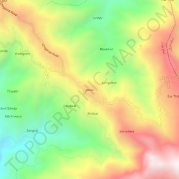
Name: Jowar topographic map, elevation, terrain.
Location: Jowar, Shangla, Khyber Pakhtunkhwa, Pakistan (34.59290 72.65516 34.63290 72.69516)
Average elevation: 5,043 ft
Minimum elevation: 3,192 ft
Maximum elevation: 7,087 ft
Thank you for supporting this site ❤️
Make a donation
Make a donation
Gear up for your next adventure:
As an Amazon Associate, this site earns from qualifying purchases at no extra cost to you.