
Thank you for supporting this site ❤️
Make a donation
Make a donation
Gear up for your next adventure:
As an Amazon Associate, this site earns from qualifying purchases at no extra cost to you.
Brøttum topographic map
Click on the map to display elevation.
Thank you for supporting this site ❤️
Make a donation
Make a donation
Gear up for your next adventure:
As an Amazon Associate, this site earns from qualifying purchases at no extra cost to you.
About this map
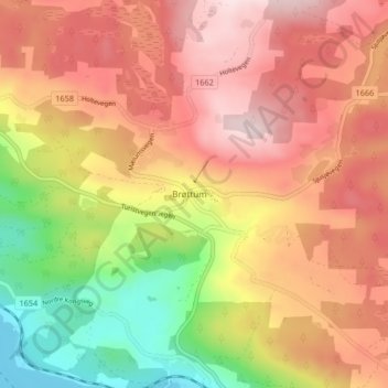
Name: Brøttum topographic map, elevation, terrain.
Location: Brøttum, Ringsaker, Innlandet, 2372, Norway (61.00852 10.53447 61.04852 10.57447)
Average elevation: 1,106 ft
Minimum elevation: 400 ft
Maximum elevation: 1,637 ft
Thank you for supporting this site ❤️
Make a donation
Make a donation
Gear up for your next adventure:
As an Amazon Associate, this site earns from qualifying purchases at no extra cost to you.