Geolocate

Hutto topographic map

Click on the map to display elevation.

About this map

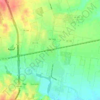
Name: Hutto topographic map, elevation, terrain.

Location: Hutto, Williamson County, Texas, 78634, United States (30.50276 -97.58689 30.58276 -97.50689)

Average elevation: 663 ft

Minimum elevation: 581 ft

Maximum elevation: 804 ft

Williamson County trails, hiking, mountain biking, running and outdoor activities

Gear up for your next adventure:

🥄Camping Utensil Set - Lightweight utensils for outdoor meals
🦟Ultrasonic Repellers - Create a bug-free zone at your camp or rest stop
🗺️NatGeo Topo Maps - High-quality waterproof printed topographic maps of US Parks
🪄Magnetic Compass - Accurate compass for navigation
🛠️Outdoor Gear Repair Kit - Essential tools to fix gear on the trail

As an Amazon Associate, this site earns from qualifying purchases at no extra cost to you.