
Thank you for supporting this site ❤️
Make a donation
Make a donation
Gear up for your next adventure:
As an Amazon Associate, this site earns from qualifying purchases at no extra cost to you.
Süderholm topographic map
Click on the map to display elevation.
Thank you for supporting this site ❤️
Make a donation
Make a donation
Gear up for your next adventure:
As an Amazon Associate, this site earns from qualifying purchases at no extra cost to you.
About this map
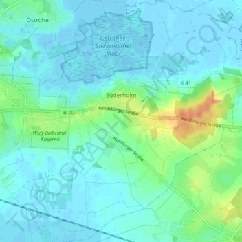
Name: Süderholm topographic map, elevation, terrain.
Location: Süderholm, Heide, Dithmarschen, Schleswig-Holstein, Deutschland (54.17283 9.13612 54.21828 9.21301)
Average elevation: 26 ft
Minimum elevation: -13 ft
Maximum elevation: 128 ft
Thank you for supporting this site ❤️
Make a donation
Make a donation
Gear up for your next adventure:
As an Amazon Associate, this site earns from qualifying purchases at no extra cost to you.