
Gilroy topographic map
Click on the map to display elevation.
Gilroy
Gilroy is approximately 16 miles (26 km) south of San Jose, California (Bailey Avenue (37.206770, -121.729150) to Monterey/Day Road (37.038210, -121.584480)) on U.S. Route 101 and 19 miles (31 km) inland from the Pacific Coast. Despite its apparent close proximity to San Jose, it is important to note that Gilroy City Hall lies at a distance of 33.3 miles (53.6 km) from San Jose City Hall. Lying in a southern extension of the Santa Clara Valley at an elevation of about 200 feet (61 m) above MSL, it is bounded by the Santa Cruz Mountains to the west and the Diablo Range to the east. According to the United States Census Bureau, the city has a total area of 16.2 square miles (42 km2), of which 16.1 square miles (42 km2) is land and 0.06% is water.
About this map
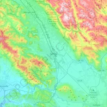
Name: Gilroy topographic map, elevation, terrain.
Average elevation: 715 ft
Minimum elevation: -20 ft
Maximum elevation: 2,779 ft
Santa Clara County trails, hiking, mountain biking, running and outdoor activities