Geolocate

Naba topographic map

Click on the map to display elevation.

About this map

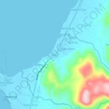
Name: Naba topographic map, elevation, terrain.

Location: Naba, Culasi, Antique, Western Visayas, Philippines (11.45669 122.05505 11.49669 122.09505)

Average elevation: 138 ft

Minimum elevation: -10 ft

Maximum elevation: 955 ft

Gear up for your next adventure:

🧭Hiking Compass - Precision compass for reliable navigation in the wilderness
🧢Sun Protection Hats - Wide-brimmed and UPF-rated hats for high-altitude sun safety
🪶Camp Gear Gift Set - Perfect gift bundle for outdoor fans
📱Heavy-Duty Phone Cases - Drop-proof and waterproof protection for outdoor navigation
📦Gear Storage Bags - Organize and protect outdoor equipment

As an Amazon Associate, this site earns from qualifying purchases at no extra cost to you.