Geolocate

Eging topographic map

Click on the map to display elevation.

About this map

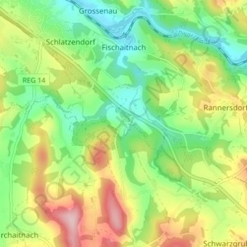
Name: Eging topographic map, elevation, terrain.

Location: Eging, Viechtach, Landkreis Regen, Bayern, 94234, Deutschland (49.03417 12.89343 49.07417 12.93343)

Average elevation: 1,604 ft

Minimum elevation: 1,329 ft

Maximum elevation: 2,028 ft

Gear up for your next adventure:

🪶Wildlife Field Guides - Learn animal tracking and species ID
🧭Orienteering Set - Complete compass and map reading kit
📻Weather Alert Radios - Stay informed of storm risks while off-the-grid
📷Action Cameras - Rugged cameras to document your journeys across rugged terrain
🌐World Map Poster - Decorative world maps with topographic info

As an Amazon Associate, this site earns from qualifying purchases at no extra cost to you.