
Make a donation
Gear up for your next adventure:
As an Amazon Associate, this site earns from qualifying purchases at no extra cost to you.
Thumb Butte topographic map
Click on the map to display elevation.
Make a donation
Gear up for your next adventure:
As an Amazon Associate, this site earns from qualifying purchases at no extra cost to you.
About this map
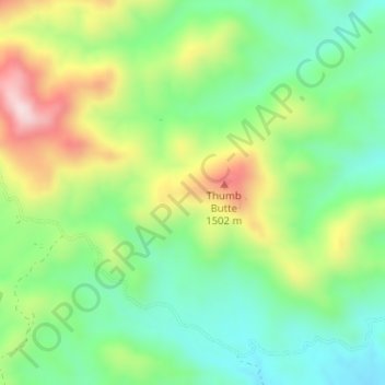
Name: Thumb Butte topographic map, elevation, terrain.
Location: Thumb Butte, Santa Cruz County, Arizona, United States (31.40005 -111.12847 31.40015 -111.12837)
Average elevation: 4,544 ft
Minimum elevation: 4,052 ft
Maximum elevation: 5,377 ft
Santa Cruz County trails, hiking, mountain biking, running and outdoor activities
Make a donation
Gear up for your next adventure:
As an Amazon Associate, this site earns from qualifying purchases at no extra cost to you.
Other topographic maps
Click on a map to view its topography, its elevation and its terrain.
Make a donation
Gear up for your next adventure:
As an Amazon Associate, this site earns from qualifying purchases at no extra cost to you.