
Thank you for supporting this site ❤️
Make a donation
Make a donation
Gear up for your next adventure:
As an Amazon Associate, this site earns from qualifying purchases at no extra cost to you.
Cancela topographic map
Click on the map to display elevation.
Thank you for supporting this site ❤️
Make a donation
Make a donation
Gear up for your next adventure:
As an Amazon Associate, this site earns from qualifying purchases at no extra cost to you.
About this map
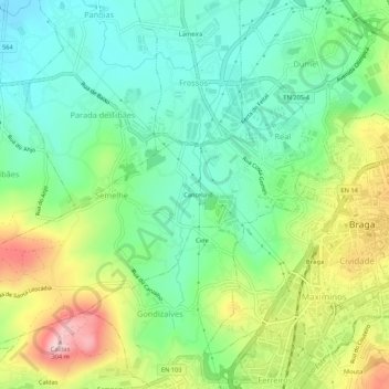
Name: Cancela topographic map, elevation, terrain.
Location: Cancela, Real, Dume e Semelhe, Braga, 4705-190, Portugal (41.53410 -8.47096 41.57410 -8.43096)
Average elevation: 381 ft
Minimum elevation: 72 ft
Maximum elevation: 961 ft
Thank you for supporting this site ❤️
Make a donation
Make a donation
Gear up for your next adventure:
As an Amazon Associate, this site earns from qualifying purchases at no extra cost to you.