
Maplewood topographic map
Click on the map to display elevation.
About this map
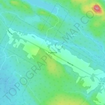
Name: Maplewood topographic map, elevation, terrain.
Average elevation: 571 ft
Minimum elevation: 466 ft
Maximum elevation: 945 ft
Other topographic maps
Click on a map to view its topography, its elevation and its terrain.
Hartfield
Canada > Nouveau-Brunswick > Communauté rurale de Nackawic-Millville > Paroisse de Southampton
Average elevation: 486 ft