
Port Jefferson topographic map
Click on the map to display elevation.
Port Jefferson
It wasn't until 1836 that the local leadership truly initiated the community's transition from a swampish hamlet to a bustling port town. Twenty-two acres of the harborfront, which flooded with the tides, were brought to a stable elevation with the construction of a causeway. Concurrently, the village was rechristened from "Drowned Meadow" to "Port Jefferson" The name choice was in honor of Thomas Jefferson.
About this map
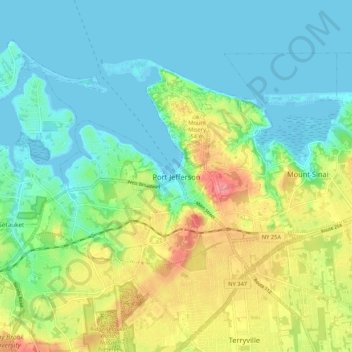
Name: Port Jefferson topographic map, elevation, terrain.
Average elevation: 85 ft
Minimum elevation: -13 ft
Maximum elevation: 269 ft
Suffolk County trails, hiking, mountain biking, running and outdoor activities