Geolocate

Netarts topographic map

Click on the map to display elevation.

About this map

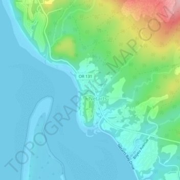
Name: Netarts topographic map, elevation, terrain.

Location: Netarts, Tillamook County, Oregon, United States (45.42350 -123.96082 45.44939 -123.93097)

Average elevation: 115 ft

Minimum elevation: -13 ft

Maximum elevation: 541 ft

Tillamook County trails, hiking, mountain biking, running and outdoor activities

Gear up for your next adventure:

🎒Hydration Pack - Hands‑free water reservoir for long hikes
🔌Solar Panel Charger - Charge gear sustainably outdoors
📻Weather Alert Radios - Stay informed of storm risks while off-the-grid
🛌Ultralight Sleeping Bags - Compact down bags for cold nights in the wilderness
🔥Fast-Boil Camping Stoves - Efficient cooking systems for quick trail meals

As an Amazon Associate, this site earns from qualifying purchases at no extra cost to you.