Geolocate

Bulle topographic map

Click on the map to display elevation.

Bulle

The municipality is the capital of the Gruyère district. It is located on a hill at an elevation of 770 meters (2,530 ft) above the left side of the Trême river.

About this map

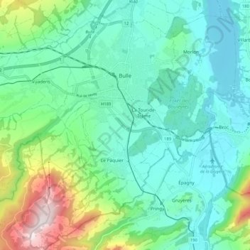
Name: Bulle topographic map, elevation, terrain.

Location: Bulle, Gruyère District, Fribourg, Switzerland (46.56952 6.99339 46.64054 7.09527)

Average elevation: 2,736 ft

Minimum elevation: 2,182 ft

Maximum elevation: 4,537 ft

Gear up for your next adventure:

☀️Outdoor Sunscreen - High protection sunscreen for outdoor activities
Backpacking Tent - Lightweight and durable tent for multi‑day hikes
🧭Map Reading Tools - Tools and kits for map navigation
🔥Fast-Boil Camping Stoves - Efficient cooking systems for quick trail meals
🧭Pro Hiking Compasses - High-accuracy liquid-filled compasses for topographic orientation

As an Amazon Associate, this site earns from qualifying purchases at no extra cost to you.