Geolocate

Mashhad topographic map

Click on the map to display elevation.

About this map

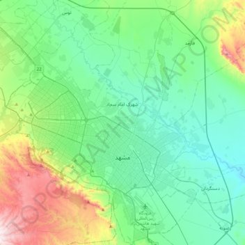
Name: Mashhad topographic map, elevation, terrain.

Location: Mashhad, بخش مرکزی شهرستان مشهد, Mashhad County, Razavi Khorasan, Iran (36.18458 59.42020 36.49895 59.72374)

Average elevation: 3,517 ft

Minimum elevation: 2,920 ft

Maximum elevation: 5,525 ft

Other topographic maps

Click on a map to view its topography, its elevation and its terrain.

Mountain Park

Iran > Razavi Khorasan > Mashhad County > Mashhad

Average elevation: 4,206 ft

Gear up for your next adventure:

🧦Merino Wool Socks - Moisture-wicking, blister-preventing socks for long treks
🧺Microfiber Travel Towels - Compact and fast-drying towels for trail use
👟Men's Trail Runners - Lightweight footwear for fast-paced exploration and light hiking
🕶️Glacier Sunglasses - Side shields to protect eyes from high-altitude snow glare
🦶Hiking Gaiters - Keep debris and water out of your boots

As an Amazon Associate, this site earns from qualifying purchases at no extra cost to you.