
Thank you for supporting this site ❤️
Make a donation
Make a donation
Gear up for your next adventure:
As an Amazon Associate, this site earns from qualifying purchases at no extra cost to you.
Frades topographic map
Click on the map to display elevation.
Thank you for supporting this site ❤️
Make a donation
Make a donation
Gear up for your next adventure:
As an Amazon Associate, this site earns from qualifying purchases at no extra cost to you.
About this map
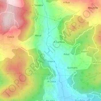
Name: Frades topographic map, elevation, terrain.
Location: Frades, Mondariz, Condado, Pontevedra, Galicia, España (42.24195 -8.48690 42.26106 -8.46014)
Average elevation: 673 ft
Minimum elevation: 171 ft
Maximum elevation: 1,280 ft
Thank you for supporting this site ❤️
Make a donation
Make a donation
Gear up for your next adventure:
As an Amazon Associate, this site earns from qualifying purchases at no extra cost to you.