Geolocate

Groton topographic map

Interactive map

Click on the map to display elevation.

About this map

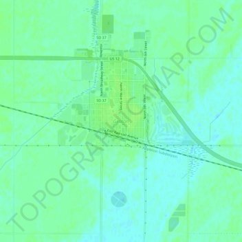
Name: Groton topographic map, elevation, terrain.

Location: Groton, Brown County, South Dakota, 57445, United States (45.42731 -98.11878 45.46731 -98.07878)

Average elevation: 1,302 ft

Minimum elevation: 1,286 ft

Maximum elevation: 1,319 ft

Other topographic maps

Click on a map to view its topography, its elevation and its terrain.

Westport

United States > South Dakota > Brown County

Westport, Westport Township, Brown County, South Dakota, United States

Average elevation: 1,355 ft

Mansfield

United States > South Dakota > Brown County

Mansfield, Brown County, South Dakota, 57460, United States

Average elevation: 1,293 ft

Aberdeen

United States > South Dakota > Brown County

Aberdeen, Brown County, South Dakota, 57401, United States

Average elevation: 1,309 ft

Moccasin Creek

United States > South Dakota > Brown County

Moccasin Creek, Brown County, South Dakota, United States

Average elevation: 1,306 ft

Groton City Limit

United States > South Dakota > Brown County > Groton City Limit

Groton City Limit, Brown County, South Dakota, United States

Average elevation: 1,306 ft

Aberdeen

United States > South Dakota > Brown County > Aberdeen

Aberdeen, Brown County, South Dakota, 57401-7699, United States

Average elevation: 1,332 ft