Geolocate

Whitekirk topographic map

Click on the map to display elevation.

About this map

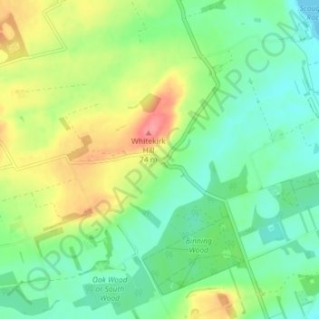
Name: Whitekirk topographic map, elevation, terrain.

Location: Whitekirk, East Lothian, Scotland, EH42 1XT, United Kingdom (56.00473 -2.67043 56.04473 -2.63043)

Average elevation: 89 ft

Minimum elevation: 0 ft

Maximum elevation: 246 ft

Other topographic maps

Click on a map to view its topography, its elevation and its terrain.

Firth of Forth

United Kingdom > Scotland > East Lothian

Average elevation: 285 ft

Lammermuirs

United Kingdom > Scotland > East Lothian

Average elevation: 873 ft

Bass Rock

United Kingdom > Scotland > East Lothian

Average elevation: 0 ft

River Esk

United Kingdom > Scotland > East Lothian > Musselburgh

Average elevation: 23 ft

Coldale Wood

United Kingdom > Scotland > East Lothian

Average elevation: 213 ft

Gear up for your next adventure:

🪑Portable Camp Table - Compact table for campsite meals
🪶Fire Starter Kit - Reliable fire starter for survival and camping
🔦Powerful Headlamps - Ultra-bright hands-free lighting for night navigation
🧥Waterproof Jacket for Hiking - Breathable and rugged rain jacket for outdoor excursions
🥾Hiking Shoes - Durable and comfortable shoes for trail hiking

As an Amazon Associate, this site earns from qualifying purchases at no extra cost to you.