Geolocate

Bigod topographic map

Click on the map to display elevation.

About this map

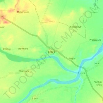
Name: Bigod topographic map, elevation, terrain.

Location: Bigod, Mandalgarh Tehsil, Bhilwara District, Rajasthan, India (25.21923 74.96894 25.29923 75.04894)

Average elevation: 1,191 ft

Minimum elevation: 1,122 ft

Maximum elevation: 1,276 ft

Gear up for your next adventure:

🔋Rechargeable Batteries - Power up your outdoor devices
🧴Hand Sanitizer - Keep hands clean while hiking
🕶️GPS Smartphone Mount - Secure mount for phone navigation
📡GPS Antenna Upgrade - Enhance GPS reception in remote terrain
⛑️Personal Locator Beacon - Safety beacon for emergencies

As an Amazon Associate, this site earns from qualifying purchases at no extra cost to you.