Geolocate

Oxwich topographic map

Click on the map to display elevation.

About this map

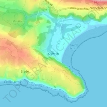
Name: Oxwich topographic map, elevation, terrain.

Location: Oxwich, Swansea, Wales, SA3 1LS, United Kingdom (51.53840 -4.18596 51.57840 -4.14596)

Average elevation: 118 ft

Minimum elevation: -7 ft

Maximum elevation: 469 ft

Gear up for your next adventure:

🧣Merino Neck Gaiters - Multi-functional headwear for wind and sun protection
🛠️Outdoor Gear Repair Kit - Essential tools to fix gear on the trail
Camping Coffee Makers - Enjoy premium coffee at the summit or campsite
📚Navigation Handbooks - Master the art of reading topographic maps and using a compass
🔋Solar Power Banks - Keep your GPS and phone charged in remote wilderness areas

As an Amazon Associate, this site earns from qualifying purchases at no extra cost to you.