
Thank you for supporting this site ❤️
Make a donation
Make a donation
Gear up for your next adventure:
As an Amazon Associate, this site earns from qualifying purchases at no extra cost to you.
Terpezë topographic map
Click on the map to display elevation.
Thank you for supporting this site ❤️
Make a donation
Make a donation
Gear up for your next adventure:
As an Amazon Associate, this site earns from qualifying purchases at no extra cost to you.
About this map
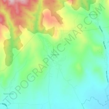
Name: Terpezë topographic map, elevation, terrain.
Location: Terpezë, Municipality of Vitina, 61000, Kosovo (42.37734 21.32549 42.41734 21.36549)
Average elevation: 1,955 ft
Minimum elevation: 1,631 ft
Maximum elevation: 2,589 ft
Thank you for supporting this site ❤️
Make a donation
Make a donation
Gear up for your next adventure:
As an Amazon Associate, this site earns from qualifying purchases at no extra cost to you.