
Cañete topographic map
Click on the map to display elevation.
About this map
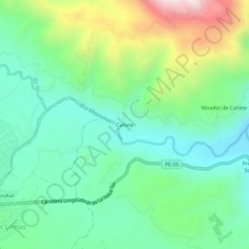
Name: Cañete topographic map, elevation, terrain.
Location: Cañete, Mazamari, Province of Satipo, Junín, Peru (-11.34164 -74.52573 -11.30164 -74.48573)
Average elevation: 2,418 ft
Minimum elevation: 1,722 ft
Maximum elevation: 4,035 ft
Other topographic maps
Click on a map to view its topography, its elevation and its terrain.