
Thank you for supporting this site ❤️
Make a donation
Make a donation
Gear up for your next adventure:
As an Amazon Associate, this site earns from qualifying purchases at no extra cost to you.
Ubiaja topographic map
Click on the map to display elevation.
Thank you for supporting this site ❤️
Make a donation
Make a donation
Gear up for your next adventure:
As an Amazon Associate, this site earns from qualifying purchases at no extra cost to you.
About this map
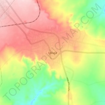
Name: Ubiaja topographic map, elevation, terrain.
Location: Ubiaja, Esan South-East, Edo State, Nigeria (6.60965 6.34897 6.68965 6.42897)
Average elevation: 771 ft
Minimum elevation: 344 ft
Maximum elevation: 1,155 ft
Thank you for supporting this site ❤️
Make a donation
Make a donation
Gear up for your next adventure:
As an Amazon Associate, this site earns from qualifying purchases at no extra cost to you.