
Thank you for supporting this site ❤️
Make a donation
Make a donation
Gear up for your next adventure:
As an Amazon Associate, this site earns from qualifying purchases at no extra cost to you.
南郷 topographic map
Click on the map to display elevation.
Thank you for supporting this site ❤️
Make a donation
Make a donation
Gear up for your next adventure:
As an Amazon Associate, this site earns from qualifying purchases at no extra cost to you.
About this map
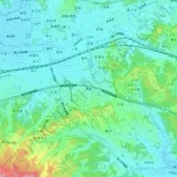
Name: 南郷 topographic map, elevation, terrain.
Location: 南郷, 掛川市, Préfecture de Shizuoka, 436-0020, Japon (34.74448 138.00934 34.78448 138.04934)
Average elevation: 174 ft
Minimum elevation: 72 ft
Maximum elevation: 522 ft
Thank you for supporting this site ❤️
Make a donation
Make a donation
Gear up for your next adventure:
As an Amazon Associate, this site earns from qualifying purchases at no extra cost to you.