
Thank you for supporting this site ❤️
Make a donation
Make a donation
Gear up for your next adventure:
As an Amazon Associate, this site earns from qualifying purchases at no extra cost to you.
Jamtalferner topographic map
Click on the map to display elevation.
Thank you for supporting this site ❤️
Make a donation
Make a donation
Gear up for your next adventure:
As an Amazon Associate, this site earns from qualifying purchases at no extra cost to you.
About this map
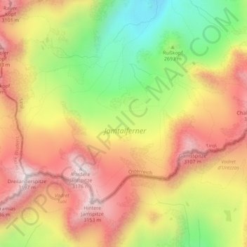
Name: Jamtalferner topographic map, elevation, terrain.
Location: Jamtalferner, Galtür, Bezirk Landeck, Tirol, Österreich (46.84564 10.14326 46.86711 10.18530)
Average elevation: 9,173 ft
Minimum elevation: 7,844 ft
Maximum elevation: 10,312 ft
Thank you for supporting this site ❤️
Make a donation
Make a donation
Gear up for your next adventure:
As an Amazon Associate, this site earns from qualifying purchases at no extra cost to you.