
Thank you for supporting this site ❤️
Make a donation
Make a donation
Gear up for your next adventure:
As an Amazon Associate, this site earns from qualifying purchases at no extra cost to you.
Gamsen topographic map
Click on the map to display elevation.
Thank you for supporting this site ❤️
Make a donation
Make a donation
Gear up for your next adventure:
As an Amazon Associate, this site earns from qualifying purchases at no extra cost to you.
About this map
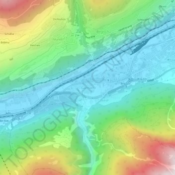
Name: Gamsen topographic map, elevation, terrain.
Location: Gamsen, Brig-Glis, Brig, Wallis, 3903, Schweiz (46.28418 7.93116 46.32418 7.97116)
Average elevation: 3,556 ft
Minimum elevation: 2,133 ft
Maximum elevation: 6,926 ft
Thank you for supporting this site ❤️
Make a donation
Make a donation
Gear up for your next adventure:
As an Amazon Associate, this site earns from qualifying purchases at no extra cost to you.