
Thank you for supporting this site ❤️
Make a donation
Make a donation
Gear up for your next adventure:
As an Amazon Associate, this site earns from qualifying purchases at no extra cost to you.
Zuriza topographic map
Click on the map to display elevation.
Thank you for supporting this site ❤️
Make a donation
Make a donation
Gear up for your next adventure:
As an Amazon Associate, this site earns from qualifying purchases at no extra cost to you.
About this map
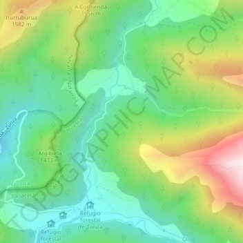
Name: Zuriza topographic map, elevation, terrain.
Location: Zuriza, Ansó, La Jacetania, Huesca, Aragón, España (42.86468 -0.81931 42.88468 -0.79931)
Average elevation: 4,537 ft
Minimum elevation: 3,812 ft
Maximum elevation: 5,919 ft
Thank you for supporting this site ❤️
Make a donation
Make a donation
Gear up for your next adventure:
As an Amazon Associate, this site earns from qualifying purchases at no extra cost to you.