Geolocate

Ughelli topographic map

Click on the map to display elevation.

About this map

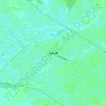
Name: Ughelli topographic map, elevation, terrain.

Location: Ughelli, Ughelli North, Delta State, Nigeria (5.45419 5.95532 5.53419 6.03532)

Average elevation: 30 ft

Minimum elevation: 13 ft

Maximum elevation: 46 ft

Gear up for your next adventure:

🧷Carabiner Set - Durable clips for gear attachment
🥄Camping Utensil Set - Lightweight utensils for outdoor meals
🔥Plasma Lighters - Windproof lighters that work in any weather condition
🔋Rechargeable Batteries - Power up your outdoor devices
🥩Freeze-Dried Meals - Nutritious and lightweight food for remote expeditions

As an Amazon Associate, this site earns from qualifying purchases at no extra cost to you.