Geolocate

Baag topographic map

Click on the map to display elevation.

About this map

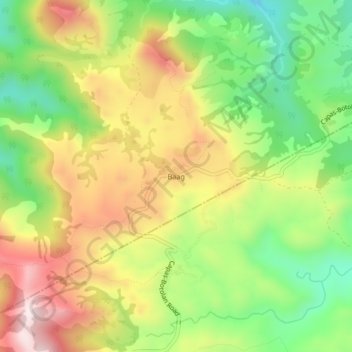
Name: Baag topographic map, elevation, terrain.

Location: Baag, San Jose, Tarlac, Central Luzon, Philippines (15.37381 120.37584 15.41381 120.41584)

Average elevation: 1,437 ft

Minimum elevation: 656 ft

Maximum elevation: 2,329 ft

Other topographic maps

Click on a map to view its topography, its elevation and its terrain.

Bulsa River

Philippines > Tarlac > San Jose

Average elevation: 325 ft

Gear up for your next adventure:

🧭Map Reading Tools - Tools and kits for map navigation
🗃️Trail First Aid Kit - Essential kit for outdoor injuries and emergencies
🌄Hiking Binoculars - Compact binoculars for scenic views and trail spotting
📡GPS Antenna Upgrade - Enhance GPS reception in remote terrain
🧭Orienteering Set - Complete compass and map reading kit

As an Amazon Associate, this site earns from qualifying purchases at no extra cost to you.