
Jang topographic map
Click on the map to display elevation.
About this map
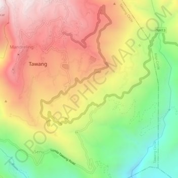
Name: Jang topographic map, elevation, terrain.
Location: Jang, Tawang Circle, Tawang district, Arunachal Pradesh, India (27.56220 91.85670 27.60220 91.89670)
Average elevation: 8,432 ft
Minimum elevation: 6,322 ft
Maximum elevation: 10,427 ft