Geolocate

Halberstadt topographic map

Click on the map to display elevation.

About this map

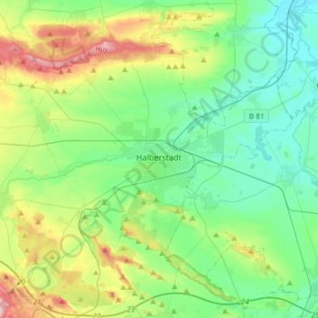
Name: Halberstadt topographic map, elevation, terrain.

Location: Halberstadt, Landkreis Harz, Saxony-Anhalt, 38820, Germany (51.83097 10.88137 51.95717 11.17484)

Average elevation: 489 ft

Minimum elevation: 266 ft

Maximum elevation: 1,083 ft

Gear up for your next adventure:

🔭Telescopic Hiking Pole - Adjustable pole for hiking stability
👓Polarized Sunglasses - Outdoor sunglasses for glare reduction
🏔️Mountain Trail Maps - High‑detail maps for popular peaks
🥾Women's Hiking Boots - Top-rated trail boots with ankle support and superior grip
📶Vehicle Signal Boosters - Improve reception in rural areas while driving to trailheads

As an Amazon Associate, this site earns from qualifying purchases at no extra cost to you.