Geolocate

Gadhada topographic map

Click on the map to display elevation.

Gadhada

Gadhada is located at 21°58′N 71°34′E / 21.97°N 71.57°E / 21.97; 71.57. It has an average elevation of 104 metres (341 feet).

About this map

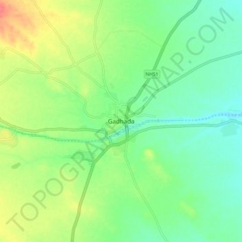
Name: Gadhada topographic map, elevation, terrain.

Location: Gadhada, Gadhada Taluka, Botad District, Gujarat, 364750, India (21.92826 71.53692 22.00826 71.61692)

Average elevation: 302 ft

Minimum elevation: 236 ft

Maximum elevation: 417 ft

Gear up for your next adventure:

🪶Paracord Bracelet - Survival bracelet with built‑in tools
🚁Photography Drones - Capture stunning aerial views of landforms and topography
🕶️Glacier Sunglasses - Side shields to protect eyes from high-altitude snow glare
🪶Thermal Camp Blanket - Extra warmth for cold nights
💧Water Filtration Bottles - Safely drink from streams and lakes while exploring

As an Amazon Associate, this site earns from qualifying purchases at no extra cost to you.