
Thank you for supporting this site ❤️
Make a donation
Make a donation
Gear up for your next adventure:
As an Amazon Associate, this site earns from qualifying purchases at no extra cost to you.
Toppo topographic map
Click on the map to display elevation.
Thank you for supporting this site ❤️
Make a donation
Make a donation
Gear up for your next adventure:
As an Amazon Associate, this site earns from qualifying purchases at no extra cost to you.
About this map
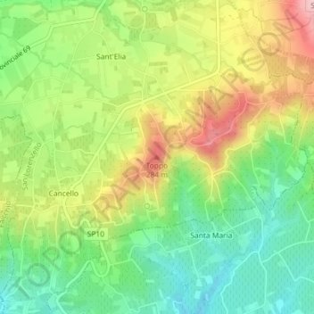
Name: Toppo topographic map, elevation, terrain.
Location: Toppo, San Lorenzello, Benevento, Campania, 82032, Italia (41.25647 14.54476 41.25657 14.54486)
Average elevation: 656 ft
Minimum elevation: 397 ft
Maximum elevation: 1,007 ft
Thank you for supporting this site ❤️
Make a donation
Make a donation
Gear up for your next adventure:
As an Amazon Associate, this site earns from qualifying purchases at no extra cost to you.