
Thank you for supporting this site ❤️
Make a donation
Make a donation
Gear up for your next adventure:
As an Amazon Associate, this site earns from qualifying purchases at no extra cost to you.
Al Mabrak topographic map
Click on the map to display elevation.
Thank you for supporting this site ❤️
Make a donation
Make a donation
Gear up for your next adventure:
As an Amazon Associate, this site earns from qualifying purchases at no extra cost to you.
About this map
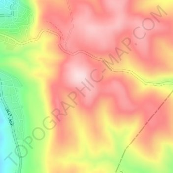
Name: Al Mabrak topographic map, elevation, terrain.
Location: Al Mabrak, Petra Sub-District, Petra District, Maan, Jordan (30.22333 35.47333 30.24333 35.49333)
Average elevation: 5,299 ft
Minimum elevation: 4,701 ft
Maximum elevation: 5,650 ft
Thank you for supporting this site ❤️
Make a donation
Make a donation
Gear up for your next adventure:
As an Amazon Associate, this site earns from qualifying purchases at no extra cost to you.