
Thank you for supporting this site ❤️
Make a donation
Make a donation
Gear up for your next adventure:
As an Amazon Associate, this site earns from qualifying purchases at no extra cost to you.
Limal topographic map
Click on the map to display elevation.
Thank you for supporting this site ❤️
Make a donation
Make a donation
Gear up for your next adventure:
As an Amazon Associate, this site earns from qualifying purchases at no extra cost to you.
About this map
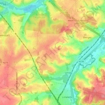
Name: Limal topographic map, elevation, terrain.
Location: Limal, Wavre, Nivelles, Walloon Brabant, Wallonia, 1302, Belgium (50.68277 4.52970 50.72393 4.61475)
Average elevation: 282 ft
Minimum elevation: 128 ft
Maximum elevation: 449 ft
Thank you for supporting this site ❤️
Make a donation
Make a donation
Gear up for your next adventure:
As an Amazon Associate, this site earns from qualifying purchases at no extra cost to you.