Geolocate

La Rosière topographic map

Click on the map to display elevation.

La Rosière

La Rosière- Espace San Bernardo se situe dans la vallée de la Tarentaise au pied du col du Petit-Saint-Bernard, dans le département de la Savoie. Son altitude varie de 1 850 à 2 800 m, la station-village est située pour sa part à 1 850 m, son point culminant est le mont Valaisan, situé à 2 891 m.

Wikipedia (CC-BY-SA 3.0)

About this map

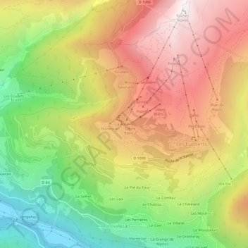
Name: La Rosière topographic map, elevation, terrain.

Location: La Rosière, Montvalezan, Albertville, Savoie, Auvergne-Rhône-Alpes, France métropolitaine, 73700, France (45.60860 6.82784 45.64860 6.86784)

Average elevation: 5,243 ft

Minimum elevation: 2,743 ft

Maximum elevation: 7,648 ft

Gear up for your next adventure:

💧Water Purification System - Clean water on the trail with reliable purifiers
🎁Geography Themed Gifts - Unique gift ideas for map lovers and geography enthusiasts
🪶Camp Gear Gift Set - Perfect gift bundle for outdoor fans
🥘Titanium Cookware - Durable, featherlight pots and pans for backpacking
🏕️Tent Footprint - Protect your tent base from wear

As an Amazon Associate, this site earns from qualifying purchases at no extra cost to you.