
Thank you for supporting this site ❤️
Make a donation
Make a donation
Gear up for your next adventure:
As an Amazon Associate, this site earns from qualifying purchases at no extra cost to you.
Mdhila topographic map
Click on the map to display elevation.
Thank you for supporting this site ❤️
Make a donation
Make a donation
Gear up for your next adventure:
As an Amazon Associate, this site earns from qualifying purchases at no extra cost to you.
About this map
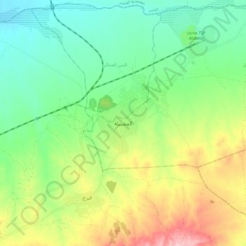
Name: Mdhila topographic map, elevation, terrain.
Location: Mdhila, المظيلة المركز, معتمدية المضيلة, Gafsa, Tunisia (34.24688 8.70803 34.32688 8.78803)
Average elevation: 892 ft
Minimum elevation: 663 ft
Maximum elevation: 1,306 ft
Thank you for supporting this site ❤️
Make a donation
Make a donation
Gear up for your next adventure:
As an Amazon Associate, this site earns from qualifying purchases at no extra cost to you.