
Llavac topographic map
Click on the map to display elevation.
About this map
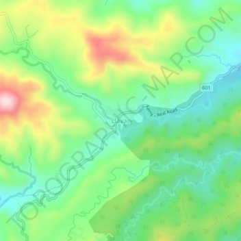
Name: Llavac topographic map, elevation, terrain.
Location: Llavac, Real, Quezon, Calabarzon, Philippines (14.50082 121.51635 14.54082 121.55635)
Average elevation: 1,204 ft
Minimum elevation: 810 ft
Maximum elevation: 1,916 ft
Other topographic maps
Click on a map to view its topography, its elevation and its terrain.
Laguna-Quezon Land Grant Lagoon
Philippines > Quezon > Real > Magsaysay > Maunlad
Average elevation: 1,276 ft